
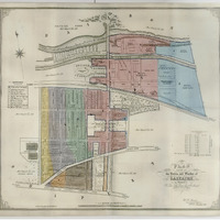
G1-022a: Shipley & Saltaire Maps
Item
- Identifier
- G1-022a
- Title
- Shipley & Saltaire Maps
- Type
- map
- Format
- printed
- Date Created
- 1889
- Creator
- Ordnance Survey
- Publisher
-
 Ordnance Survey
- Description
- Spiral bound copy of enlarged photocopies of OS Map 1:500 (Saltaire & Shipley) (1889)
- Subject
- Maps and guides
- Associated place or event
-
 Saltaire, West Yorkshire, United Kingdom
- Persistent address
- https://explore.saltairecollection.org/s/p/item/5645
- Item sets
- Saltaire Collection
Export
Catalogue data (excluding media) available under Creative Commons Attribution-ShareAlike (CC BY-SA 4.0) licence.